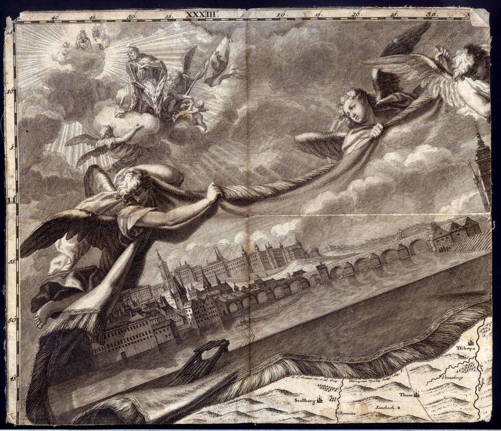
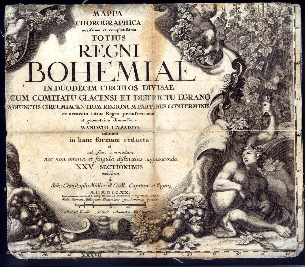
| dc.contributor | Müller, Johann Christoph (1673-1721) (alapján) | |
| dc.contributor | Wieland, Johann Wolfgang (?-1757) (kész.) | |
| dc.contributor | Kauffer, Michael (1673-1756) (metsző) | |
| dc.contributor | Reinner, Wenzel Lorenz (1689-1743) (rajz.) | |
| dc.contributor | Sperling, Hieronymus (1695-1777) (metsző) | |
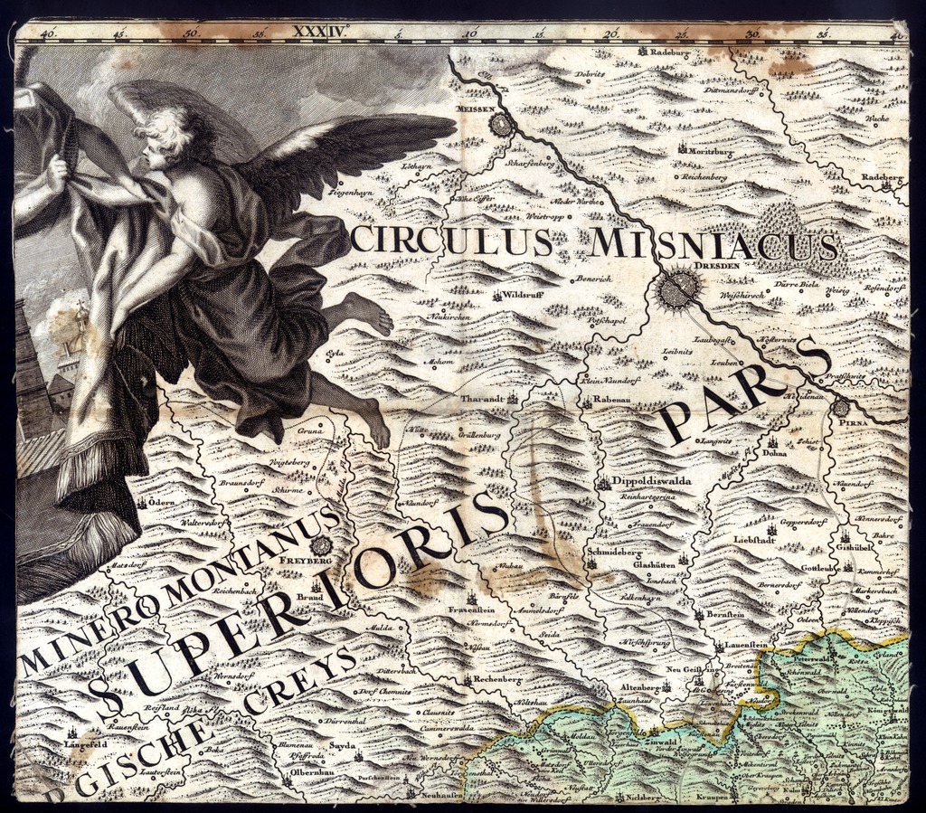
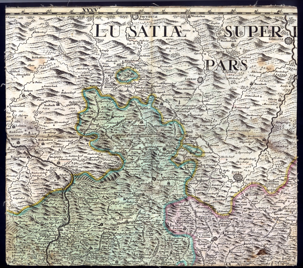
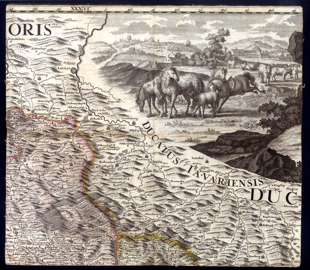
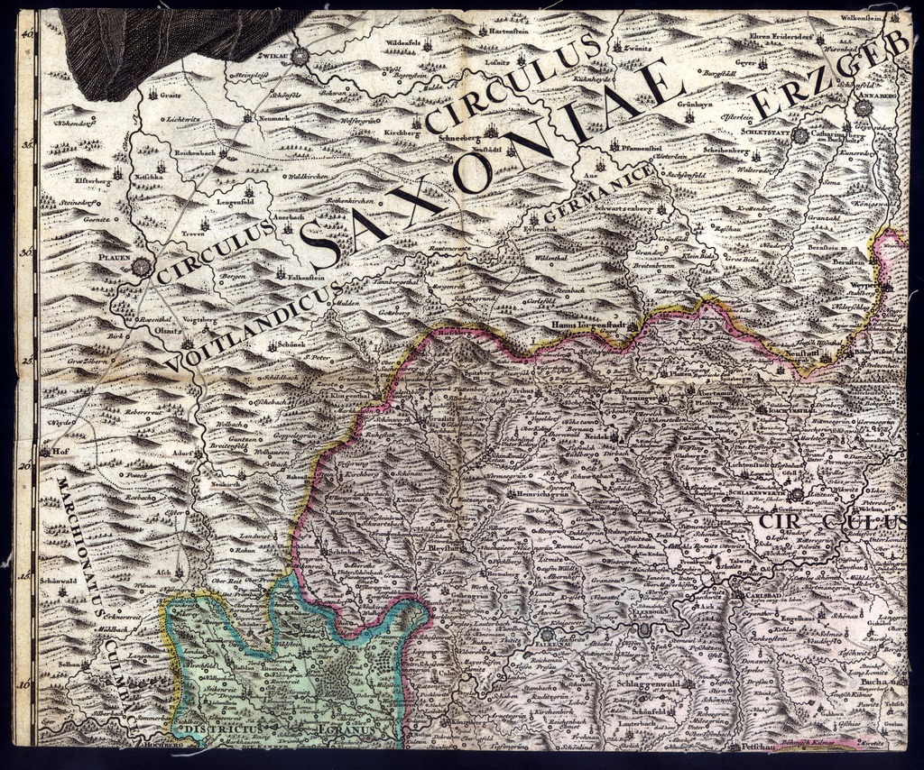
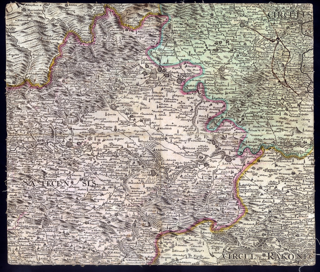
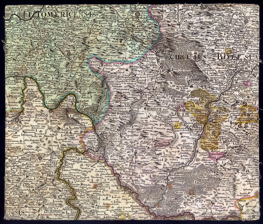
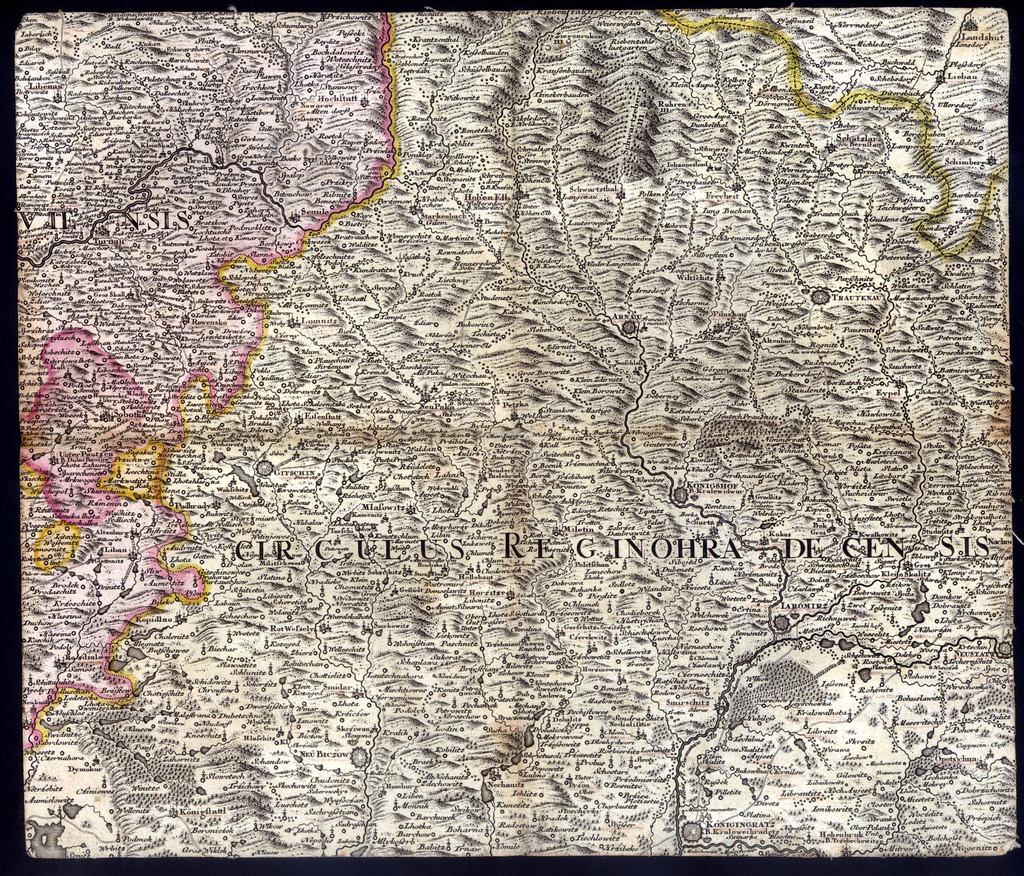
| dc.coverage.spatial | [1:230 000] Scala duorum Milliarum Bohemicor: seu horarum quator [= 79 mm] | |
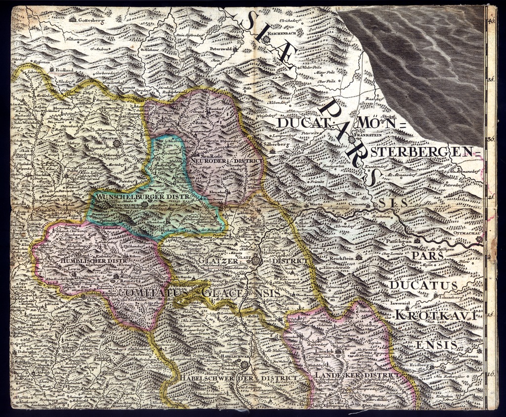
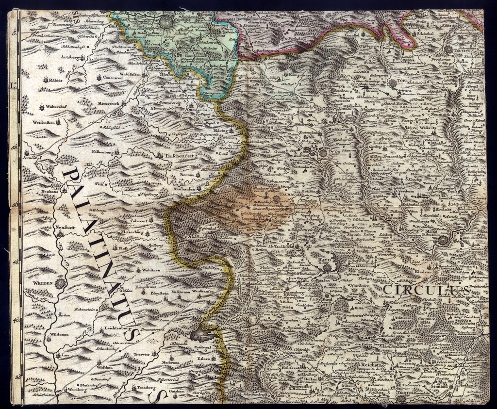
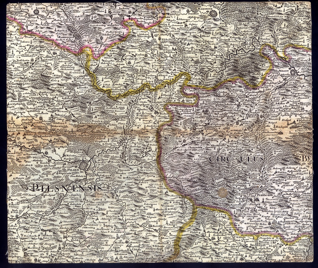
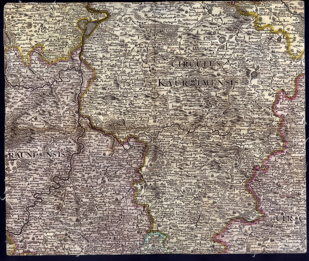
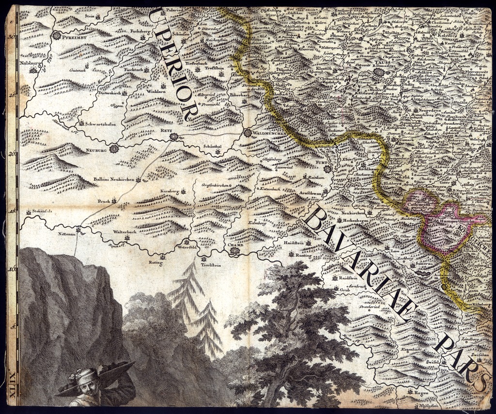
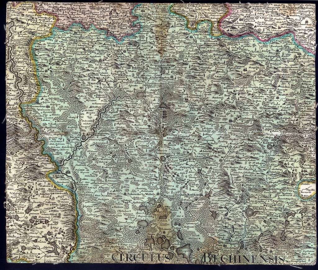
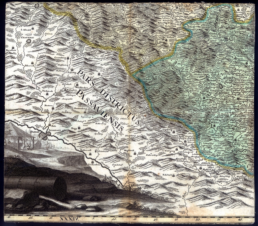
| dc.coverage.spatial | Csehország | |
| dc.date.accessioned | 2016-03-11T23:43:52Z | |
| dc.date.available | 2016-03-11T23:43:52Z | |
| dc.date.copyright | 1726 | |
| dc.date.issued | 1726 | |
| dc.identifier.uri | https://ds.oszk.hu/xmlui/handle/123456789/94721 | |
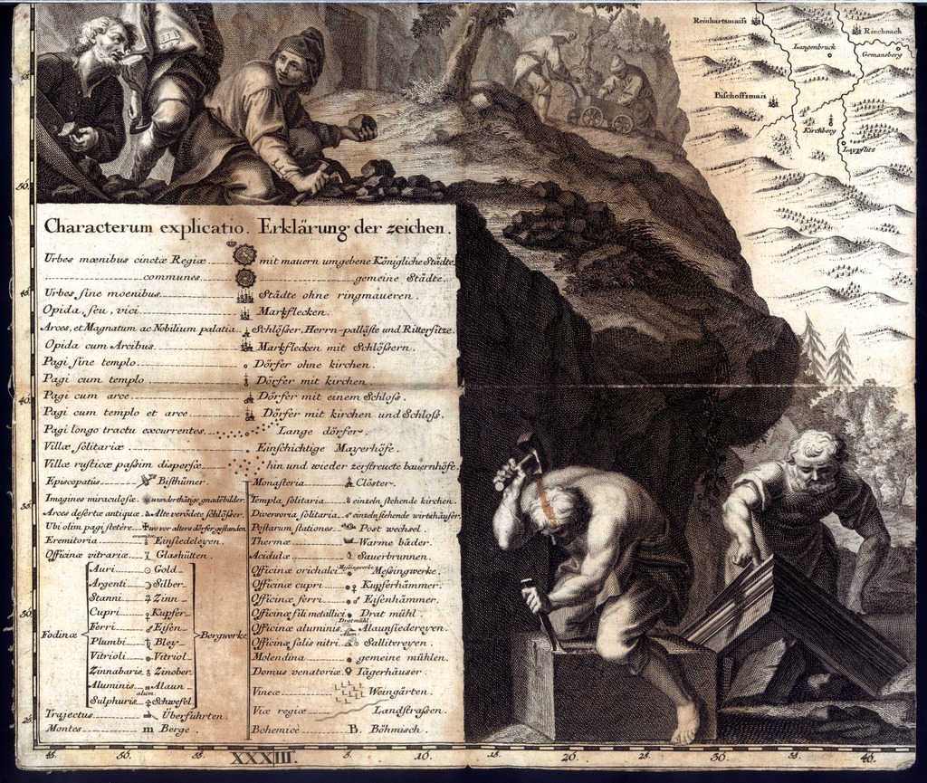
| dc.description | W. L. Reinner és H. Sperling az allegóriák rajzolója, ill. metszője | |
| dc.description | A teljes mű mérete: 139x166 cm | |
| dc.format.extent | 1 térk. (25 szelv.) | |
| dc.format.medium | rézmetszet, kézi szín. | |
| dc.format.medium | 27,8x33,5 cm | |
| dc.publisher | [s.n.] | |
| dc.title | MAPPA CHOROGRAPHICA novissima et completissima TOTIUS REGNI BOHEMIAE IN DUODECIM CIRCULOS DIVISAE CUM COMITATU GLACENSI ET DISTRICTU EGRANO ADIUNCTIS CIRCUMIACENTIUM REGIONUM PARTIBUS CONTERMINIS ex accurata totius Regni perlustratione et geometrica dimensione MANDATO CÆSAREO institut^a | |
| dc.title.alternative | Csehország (általános térkép) (1726) | |
| dc.type | Cartographic | |
| dc.type | általános térkép | |
| dc.publication | [Praha] : [s.n.], [1726] | |
| dc.identifier.collection | OSZK-2525774 | |
| dc.identifier.location | TF 697 | |
| dc.identifier.location | TR 611 arch | |
| dc.identifier.location | TR 611 | |
| dc.identifier.location | TR 611/7:2 | |