| dc.contributor | Senex, John (1678-1740) (kész. és közreadó) | |
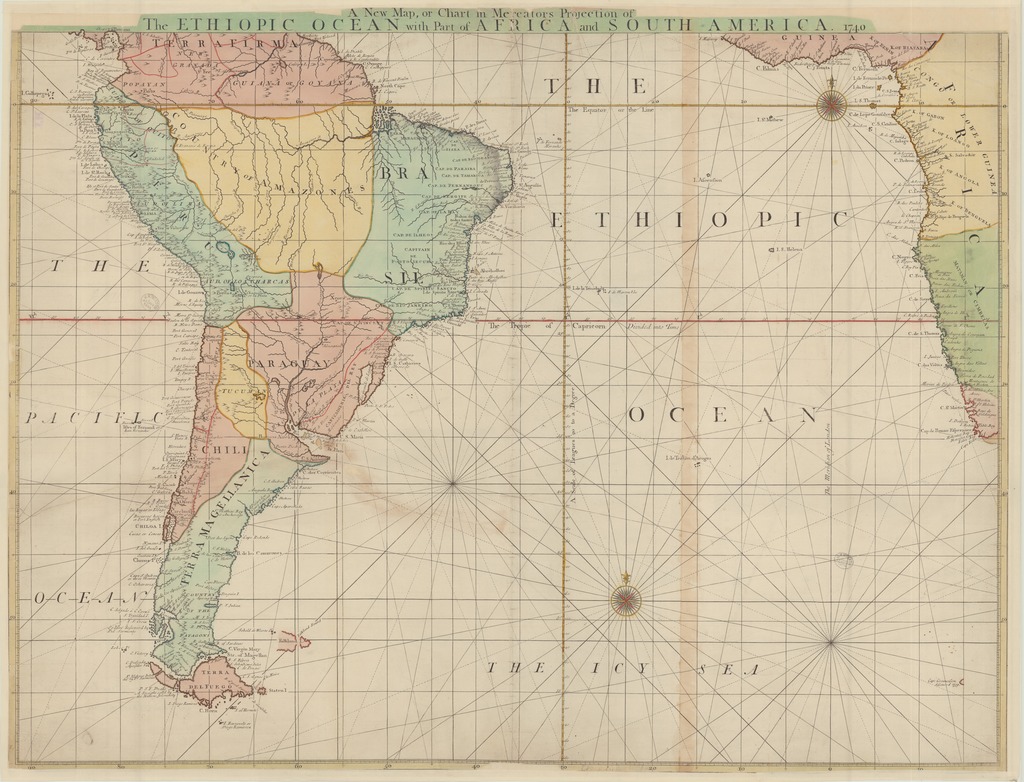
| dc.coverage.spatial | [1:12 000 000] A Scale of Leagues 20 to a Degree, 100 [= 47 mm] | |
| dc.coverage.spatial | Atlanti-óceán | |
| dc.date.accessioned | 2016-03-11T20:35:23Z | |
| dc.date.available | 2016-03-11T20:35:23Z | |
| dc.date.copyright | 1740 | |
| dc.date.issued | 1740 | |
| dc.identifier.uri | https://ds.oszk.hu/xmlui/handle/123456789/94054 | |
| dc.description | Az ábrázol terület: Dél-Amerika, valamint Afrika nyugati partvidéke | |
| dc.format.extent | 1 térkl. | |
| dc.format.medium | rézmetszet, kézi szín. | |
| dc.format.medium | 57x77,2 cm | |
| dc.publisher | [John Senex] | |
| dc.title | A New Map, or Chart in Mercators Projection of he ETHIOPIC OCEAN with Part of AFRICA and SOUTH AMERICA 1740 | |
| dc.title.alternative | Atlanti-óceán (közlekedési térkép) (1740) | |
| dc.type | Cartographic | |
| dc.type | hajózási térkép | |
| dc.publication | [London] : [John Senex], 1740 | |
| dc.identifier.collection | OSZK-2537727 | |
| dc.identifier.location | TR 1 894 | |