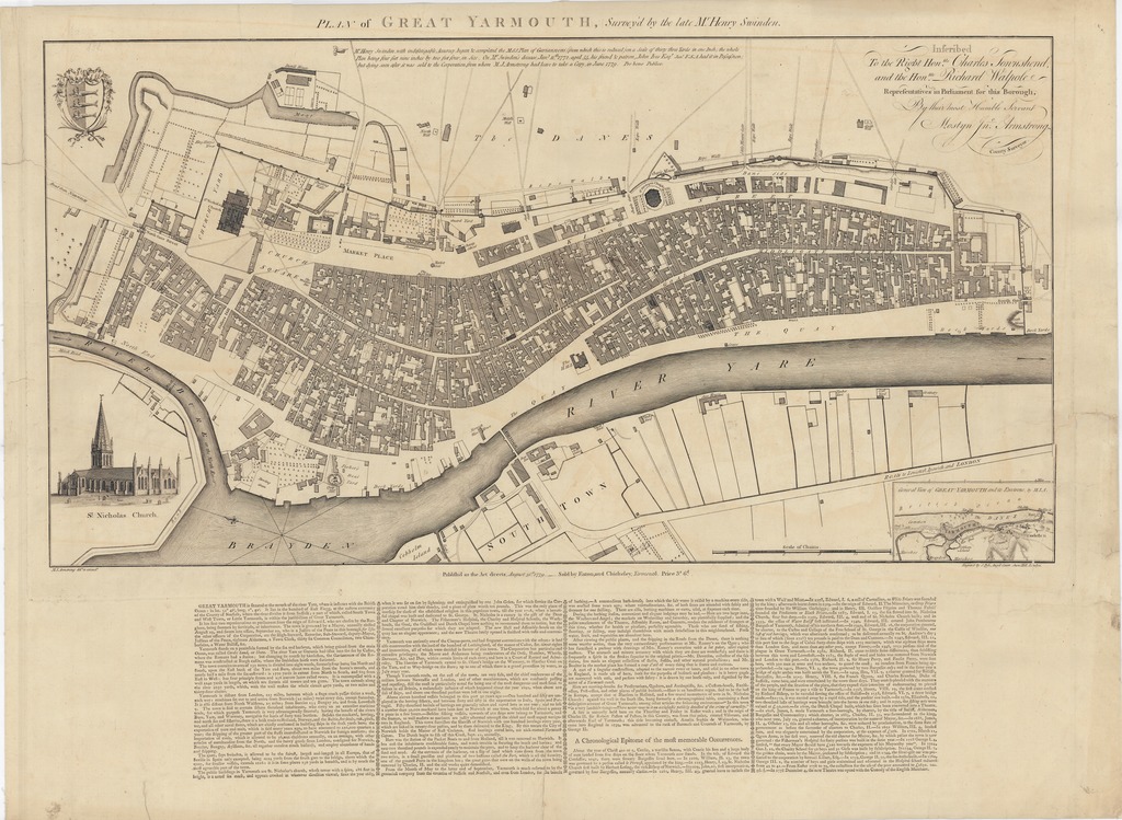
| dc.contributor | Swinden, Henry (1716-1772) (közrem.) | |
| dc.contributor | Armstrong, Mostyn John (fl. 1769-1791) (szerk. és közreadó) | |
| dc.contributor | Pyle, Stephen (metsző) | |
| dc.coverage.spatial | [1:2200] Scale of Chains, 15 [= 124 mm] | |
| dc.coverage.spatial | Great Yarmouth | |
| dc.date.accessioned | 2016-03-11T22:04:01Z | |
| dc.date.available | 2016-03-11T22:04:01Z | |
| dc.date.copyright | 1779 | |
| dc.date.issued | 1779 | |
| dc.identifier.uri | https://ds.oszk.hu/xmlui/handle/123456789/93980 | |
| dc.description | Keleti tájolású | |
| dc.description | Teljes méret címmel, a lemezhatárig: 41,2x72,8 cm ; a tipográfiai szöveggel, a papírszélig: 56,7x77,5 cm | |
| dc.description | A felmérő, H. Swinden érdemeinek részletes ismertetésével | |
| dc.description | Teljes terjesztői felirat: Publish'd as the Act directs, August 31.st 1779. Sold by Eaton, and Chicheley, Yarmouth, Price 3. s 6.d | |
| dc.format.extent | 1 térkl. | |
| dc.format.medium | rézmetszet | |
| dc.format.medium | 36,3x69,7 cm | |
| dc.publisher | M. I. Armstong | |
| dc.publisher | sold by Eaton, and Chicheley [terj.] | |
| dc.title | PLAN of GREAT YARMOUTH - Survey'd by the late M.r Henry Swinden. | |
| dc.title.alternative | Great Yarmouth (általános térkép) (1779) | |
| dc.type | Cartographic | |
| dc.type | településtérkép | |
| dc.publication | [Norfolk] : M. I. Armstong [Great] Yarmouth : sold by Eaton, and Chicheley [terj.], 1779 | |
| dc.identifier.collection | OSZK-2759258 | |
| dc.identifier.location | TR 1 770 | |